On Monday, we picked up a
rental car and began a weeklong road trip adventure: driving the Mae Hong Son
loop, followed by a visit to the Golden Triangle. The Mae Hong Son loop starts in Chiang Mai
and follows some of the region’s windiest roads along a loop west of the
city. We were far enough west that, for
most of our trip, we were just kilometers from the border with Myanmar.
Chiang Mai to Mae Sariang:
Climbing Thailand’s Tallest Mountain
 After picking up our tiny
car (a Toyota Yaris), we immediately decided to put it to the test by ascending
the highest peak in Thailand: Doi Inthanon.
Giorgio, our team’s driver extraordinaire, had no trouble readjusting to
driving on the wrong side of the road.
Stephanie almost never interrupted his turns to shout, “look right!” And except for a brief moment of panic when a
giant bag full of bottles flew off a garbage truck (aiming directly at our
windshield), we made it to the base of Doi Inthanon unscathed. Fortunately, they were plastic bottles,
because even though we were able to swerve to miss the bag, a few bounced off our windshield.
After picking up our tiny
car (a Toyota Yaris), we immediately decided to put it to the test by ascending
the highest peak in Thailand: Doi Inthanon.
Giorgio, our team’s driver extraordinaire, had no trouble readjusting to
driving on the wrong side of the road.
Stephanie almost never interrupted his turns to shout, “look right!” And except for a brief moment of panic when a
giant bag full of bottles flew off a garbage truck (aiming directly at our
windshield), we made it to the base of Doi Inthanon unscathed. Fortunately, they were plastic bottles,
because even though we were able to swerve to miss the bag, a few bounced off our windshield.
 Unlike many mountains, Doi
Inthanon is accessed via a network of paved roads that climb all the way to the
top of the 2,565 meter peak. Therefore,
a trip to this Thai national park is not exactly an extreme endeavor. Regardless, the mountain is located in a national park
that boasts numerous lovely waterfalls, temples surrounded by scenic gardens,
and, of course, the highest point in the country.
Unlike many mountains, Doi
Inthanon is accessed via a network of paved roads that climb all the way to the
top of the 2,565 meter peak. Therefore,
a trip to this Thai national park is not exactly an extreme endeavor. Regardless, the mountain is located in a national park
that boasts numerous lovely waterfalls, temples surrounded by scenic gardens,
and, of course, the highest point in the country.
At our first stop,
Mae Klang Waterfall, one of the signs mentioned that the cascade was the most
beautiful waterfall to be found in the entire park. We were a little concerned about the
prospects for the rest of the day when, after a short walk from the parking
lot, we arrived at a pretty, but somewhat unimpressive, waterfall.
Over the course of the
day, however, we determined that the initial sign was incorrect; Doi Inthanon’s
best waterfalls were yet to come. As our
Yaris climbed the switchbacks to the summit, we stopped to see various beautiful
cascades hiding in the verdant green jungle.
There are probably hundreds of these waterfalls, but we only found the
ones marked in English; as we drove further away from Chiang Mai, the percentage
of signs (that is, both traffic and tourist signs) in English dropped from 100% to about 15%. Who knows what we missed!


Near the summit, the Thai
Royal Air Force has erected two modern temples set amidst laboriously
cultivated gardens. From the temples,
the rolling green hills of northern Thailand spread out for miles. Despite being mostly “templed out,” we were quite
excited to find what we have appropriately named the “Williams Temple” – an edifice
with a purple base and an actual gold stupa.
Can it get any more beautEPHul than that? Aside from the pagodas, the gardens were
immaculately kept and we were delighted to find homemade pork buns being sold
by the parking lot.


We continued our way up
the mountain, occasionally worrying that our little Yaris would not have enough
power to complete the ascent.
Fortunately, we managed to reach the top, where we parked our car and
set out on foot for the final 50 meters.
A short walk later, we had made it to the highest peak in Thailand –
2,565.3341 meters above sea level. Other
than a couple signs commemorating the elevation, this was
a somewhat anticlimactic experience, as the views from the Williams Temple were
much better.
 Contrary to Laos, the “shaRp curves” in Thailand are for real. We
drove part way down the mountain only to be faced with yet another steep ascent. Giorgio kept driving up and down the hills,
constantly changing altitude from about 2,000 meters above sea level to 500
meters and back up again, all while navigating one hairpin turn after another. Just imagine starting a right
turn and immediately come across a left turn road sign (and vice-versa).
Contrary to Laos, the “shaRp curves” in Thailand are for real. We
drove part way down the mountain only to be faced with yet another steep ascent. Giorgio kept driving up and down the hills,
constantly changing altitude from about 2,000 meters above sea level to 500
meters and back up again, all while navigating one hairpin turn after another. Just imagine starting a right
turn and immediately come across a left turn road sign (and vice-versa).
We eventually arrived at
our destination for the evening – Mae Sariang – a sleepy town along the banks
of a river. Goats and cows, all with
their bells jingling, roamed the opposite bank. The hills in the distance were all that separated us from Myanmar.
We set out to explore the
small town, which was not exactly a bustling metropolis. Regardless, we stumbled upon a small night
market with four or five food stalls.
Like many of the restaurants and carts we encountered on the loop, English-language
menus (or menus with photos) were nowhere to be found. When someone in front of us ordered pad
thai and we saw the man behind the wok cook the familiar dish, we decided to do
some pointing and hand gesturing to indicate we wanted two of the same. We ended up with the best pad thai of our
trip!
Mae Sariang to Mae Hong Son: Conquering
the Hairpin Turns of Route 108
 For our drive the second
day, we made our way north, driving parallel to the border with Myanmar. Our first drive had provided good training,
as the roads became increasingly windy between Mae Sariang and Mae Hong Son.
For our drive the second
day, we made our way north, driving parallel to the border with Myanmar. Our first drive had provided good training,
as the roads became increasingly windy between Mae Sariang and Mae Hong Son.
 Along the way, we had planned
to stop at a few of the places marked on our map, which contained various
symbols for caves, waterfalls, and scenic viewpoints. With most of the signs in Thai, we once again ended up missing many of the turn-offs for these sites. Regardless, we managed to visit some of the attractions, including the Kaeo
Komon Cave (after a quick U-turn, of course). This is
apparently the only calcite cave in Southeast Asia and was hidden in the hills
a few kilometers off the highway. We
were the only visitors at the cave that morning and no one seemed to speak any English, but they
managed to communicate enough for us to pay for our tickets and hop into the
back of a pick-up truck for the final ascent to the cave.
Along the way, we had planned
to stop at a few of the places marked on our map, which contained various
symbols for caves, waterfalls, and scenic viewpoints. With most of the signs in Thai, we once again ended up missing many of the turn-offs for these sites. Regardless, we managed to visit some of the attractions, including the Kaeo
Komon Cave (after a quick U-turn, of course). This is
apparently the only calcite cave in Southeast Asia and was hidden in the hills
a few kilometers off the highway. We
were the only visitors at the cave that morning and no one seemed to speak any English, but they
managed to communicate enough for us to pay for our tickets and hop into the
back of a pick-up truck for the final ascent to the cave.
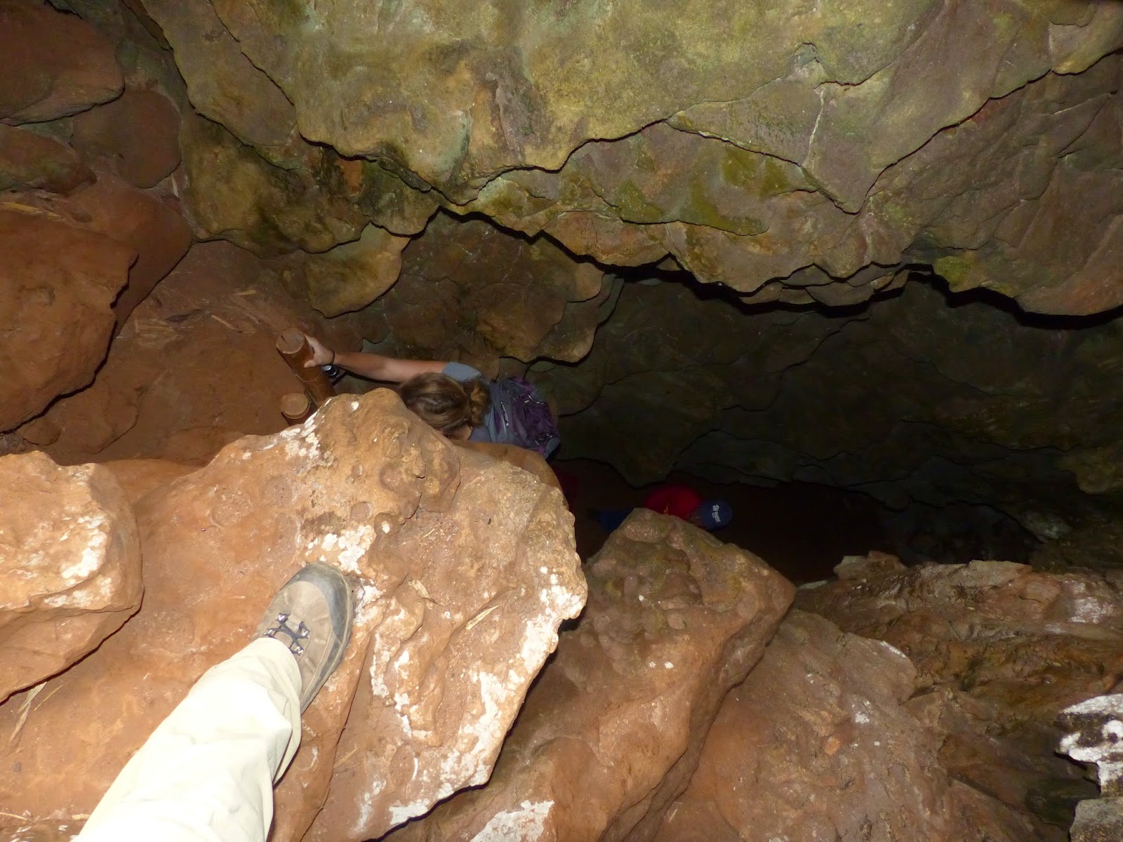
 At the cave’s entrance,
one of the guides gestured to a list of English-language rules for our
visit. In addition to avoiding taking
photos, we were instructed not to remain underground for more than 20 minutes,
due to the low levels of oxygen and high levels of heat in the cave. Given that no one accompanied us to make sure we followed the rules (or died), we disregarded the instructions related to taking photos. The 20-minute time limit, however, seemed a little bit more important so we made sure
to constantly check our watches. Inside the cave,
we quickly descended several staircases; as promised, it was quite warm and
there at least seemed to be less oxygen than usual, although it could have just
been the power of suggestion. Complex calcite
formations surrounded us and we were even more impressed when we learned they were
apparently almost 500 million years old.
At the cave’s entrance,
one of the guides gestured to a list of English-language rules for our
visit. In addition to avoiding taking
photos, we were instructed not to remain underground for more than 20 minutes,
due to the low levels of oxygen and high levels of heat in the cave. Given that no one accompanied us to make sure we followed the rules (or died), we disregarded the instructions related to taking photos. The 20-minute time limit, however, seemed a little bit more important so we made sure
to constantly check our watches. Inside the cave,
we quickly descended several staircases; as promised, it was quite warm and
there at least seemed to be less oxygen than usual, although it could have just
been the power of suggestion. Complex calcite
formations surrounded us and we were even more impressed when we learned they were
apparently almost 500 million years old.
 Having survived the low
oxygen levels of the cave, we were back in our Toyota Yaris continuing north to
Mae Hong Son along the winding road. En route, we made our
second stop of the day at the Japanese-Thai Friendship Museum in Khun Yuam;
also referred to as the Khun Yuam WWII Japaense War Museum. This very small mountain town used to serve as the
Japanese base for their offensive into Myanmar during WWII. Thousands of troops later had to pass back through
the town on their retreat to Japan at the end of the war. Many of the troops never made it all the way
home as they succumbed to malaria and other illnesses and are buried in mass graves in Khun Yuam. This
somber location details Thailand’s involvement in the war and describes the
apparently friendly relationship between soldiers and villagers. To better illustrate these friendly relations, we were treated to an incredibly tacky movie reenactment of the ill-fated romance between a soldier and a local woman.
Having survived the low
oxygen levels of the cave, we were back in our Toyota Yaris continuing north to
Mae Hong Son along the winding road. En route, we made our
second stop of the day at the Japanese-Thai Friendship Museum in Khun Yuam;
also referred to as the Khun Yuam WWII Japaense War Museum. This very small mountain town used to serve as the
Japanese base for their offensive into Myanmar during WWII. Thousands of troops later had to pass back through
the town on their retreat to Japan at the end of the war. Many of the troops never made it all the way
home as they succumbed to malaria and other illnesses and are buried in mass graves in Khun Yuam. This
somber location details Thailand’s involvement in the war and describes the
apparently friendly relationship between soldiers and villagers. To better illustrate these friendly relations, we were treated to an incredibly tacky movie reenactment of the ill-fated romance between a soldier and a local woman.
As we approached Mae Hong
Son, we were on the lookout for what another blog promised would be coffee with
the best view at precisely 17km before the town. Sure enough, we found a tiny coffeeshop at
the 17km marker and settled in with our iced treats to appreciate the stunning
view before completing the day’s drive.
Mae Hong Son to Soppong: Getting
Lost in the Jungle
For our stopover in Mae
Hong Son, we opted to stay at a small eco-resort outside of town. Gio has an intense aversion to lodging
labeled as “eco-anything,” which, in our experience, is often a
little too close to nature for comfort. This
turned out to be the perfect plan, though, since the resort was adjacent to one
of Thailand’s national parks (and “eco” did not extend to include sleeping
among hordes of mosquitoes or anything else too close to nature). We found a map for a half-day hike with
directions in English (a rarity on this portion of our trip) and set off into
the jungle.


When the first few signs
included mystery directions only in Thai, we figured this was the way we would
end up lost in the jungle in Thailand. Instead,
the trail turned out to have plenty of English-language signs explaining the
various flora and fauna along the route. Not only did we not get lost, we saw three
beautiful waterfalls and marveled at the amazing views of Mae Hong Son’s
rolling hills and temples from the top of the mountain. We were also the only ones on the trail to
appreciate all of this!
After the morning’s
exertions, we spent the rest of the afternoon exploring the city’s market and temples. From the terrace of Wat Phra That Doi Kong Mu,
a Burmese style temple, we even spotted our trail from earlier in the day!
Our destination for the
night was Soppong, also known as Pang Mapha.
This small town is set in a valley and can only be reached by even
windier roads. We did not count them,
but multiple signs insist the road includes 1,864 curves.
Spelunking in Soppong
We decided to spend two
nights in Soppong, both to take a break from driving the continuously twisting
roads and to explore a few of the area’s many caves. Most drivers on the loop actually stop in a
town called Pai rather than Soppong, but we had read that Pai was such a
popular riverside town that it was absolutely full of foreigners (or “dirty
hippies,” to use Steph’s exact words) – not the low key rural experience we
were looking for.
We started our
cave-hopping day at Tham Lod. Although
this means “spirit cave” in Thai, we renamed it the "Horcrux Cave" as our guide
poled us through the cave entrance on a narrow bamboo raft. A river full of enormous catfish runs through
Tham Lod and provides visitors with access to its dark inner caverns.
Our guide docked the raft
along one of the sandy riverbanks inside the cave and we followed her to explore
the multiple dark chambers hidden in the cave complex. Although we did not
encounter any horcruxes, we did find plenty of crazy rock formations, ancient
coffins, and one very smudged cave painting (not to mention a lot of bird and
bat droppings).


In addition to Tham Lod, our road map had several caves marked, but none of them were in the guidebook or online
(or at least not online in English). We
decided to set off in the direction of Mae Lana cave and see what would
happen. We took another narrow and winding
highway north, coming even closer to Myanmar.
Our Yaris barely made it through the various villages as
the steep road abruptly changed from asphalt to dirt and back again. We arrived at a police checkpoint just as we
were starting to think we had taken a wrong turn. The officers looked at us askance when we
asked about the cave, but then simply smiled and indicated that the turnoff was
up ahead on the right-hand side of the road.
 We eventually made it to
the entrance to a series of caves, including the one we were looking for. Upon being informed that the Mae Lana cave
was not only the longest cave in Asia at 12 kilometers, but also had almost
a meter of water to wade through for those 12km and would take about 4 hours to
explore, we opted to investigate the Diamond and Coral Caves instead. One of the guides hopped in our car to direct
us to their entrances in the valley below.
We eventually made it to
the entrance to a series of caves, including the one we were looking for. Upon being informed that the Mae Lana cave
was not only the longest cave in Asia at 12 kilometers, but also had almost
a meter of water to wade through for those 12km and would take about 4 hours to
explore, we opted to investigate the Diamond and Coral Caves instead. One of the guides hopped in our car to direct
us to their entrances in the valley below.
 These caves proved to be a
bit more of an adventure than Tham Lod, which is more firmly on the tourist track.
For all we know, we were the only ones
who showed up to see the caves that day since we didn’t see any other tourists
on the road or in the villages we passed.
The adventure began at the entrance to each cave, one of which was
hidden and one of which required a descent down a ladder into the
darkness.
These caves proved to be a
bit more of an adventure than Tham Lod, which is more firmly on the tourist track.
For all we know, we were the only ones
who showed up to see the caves that day since we didn’t see any other tourists
on the road or in the villages we passed.
The adventure began at the entrance to each cave, one of which was
hidden and one of which required a descent down a ladder into the
darkness.
No signs or illumination
of any kind were provided inside, so we were left with the minimal light
provided by our headlamps. In the dim
light, we clambered along the 700m length of the Diamond Cave and the full
kilometer of the Coral Cave. We reached
what appeared to be the end of each cave several times, only for our guide to
scramble up a steep rock face or squeeze through a narrow hidden passageway. Our guide did not speak much English and many of his explanations were done via sound effects and hand gestures. Besides the resident bats, we were surprised
to find all sorts of weird forms of life along the way, including grasshoppers,
gigantic spiders, millipedes, frogs, and of course, cockroaches (who can
survive anywhere).
 From Soppong, we continued
east to complete the Mae Hong Son loop and headed onward in the pouring rain to the
northeast corner of the country. Known
as the Golden Triangle, where Thailand borders both Laos and Myanmar – details
to follow!
From Soppong, we continued
east to complete the Mae Hong Son loop and headed onward in the pouring rain to the
northeast corner of the country. Known
as the Golden Triangle, where Thailand borders both Laos and Myanmar – details
to follow!
#stephandgio
 On Friday, we completed
the final leg of the Mae Hong Son Loop, including the remainder of the 1,864 curves. After stopping for a quick breakfast in Pai
(which, as it turns out, does have plenty of hippies and was not nearly as
tranquil as Soppong), we were back on the main highway heading east to the
Golden Triangle.
On Friday, we completed
the final leg of the Mae Hong Son Loop, including the remainder of the 1,864 curves. After stopping for a quick breakfast in Pai
(which, as it turns out, does have plenty of hippies and was not nearly as
tranquil as Soppong), we were back on the main highway heading east to the
Golden Triangle. This time, in addition to the ups and downs and multiple switchbacks, we had to deal with a good old fashioned tropical downpour. Fortunately, we managed to get to our destination safely. We did, however, witness another small car having difficulty on a hill as its wheels spun in the water, as well as a courageous man on a scooter crashing as he attempted a curve.
 The Golden Triangle is not
just a unique quirk of geography and a catchy name. It is also the source of extensive illegal
trade in opium. Particularly during the
1960s and 1970s, the region was notorious for the lawlessness engendered by the
demand for opium and heroin. The Thai
government has since cracked down on the drug rings and worked on multiple
initiatives to provide alternatives for farmers aside from cultivating
poppy. Captained by the Princess Mother,
the government has gone to great lengths to educate locals and foreigners alike
about the negative effects of drugs and has even erected a large museum
explaining in detail the history and consequences of the opium trade.
The Golden Triangle is not
just a unique quirk of geography and a catchy name. It is also the source of extensive illegal
trade in opium. Particularly during the
1960s and 1970s, the region was notorious for the lawlessness engendered by the
demand for opium and heroin. The Thai
government has since cracked down on the drug rings and worked on multiple
initiatives to provide alternatives for farmers aside from cultivating
poppy. Captained by the Princess Mother,
the government has gone to great lengths to educate locals and foreigners alike
about the negative effects of drugs and has even erected a large museum
explaining in detail the history and consequences of the opium trade.

 The Hall of Opium didn’t
just have bizarre tunnels; there were life-size dioramas of opium dens, PSAs
about the debilitating effects of doing drugs, and a Chinese-sponsored exhibit
about the devastating effects and injustice of the opium wars. In all seriousness though, the museum
provided a comprehensive history of the opium trade that was significantly more
interesting and educational than we had expected. Of particular interest were the videos describing
the role of the CIA in the region. The
clips were particularly critical of the CIA’s support
for multiple international groups who openly financed their operations with
proceeds from drug trafficking.
The Hall of Opium didn’t
just have bizarre tunnels; there were life-size dioramas of opium dens, PSAs
about the debilitating effects of doing drugs, and a Chinese-sponsored exhibit
about the devastating effects and injustice of the opium wars. In all seriousness though, the museum
provided a comprehensive history of the opium trade that was significantly more
interesting and educational than we had expected. Of particular interest were the videos describing
the role of the CIA in the region. The
clips were particularly critical of the CIA’s support
for multiple international groups who openly financed their operations with
proceeds from drug trafficking.
 Our guidebook also
described a small plot of land in the middle of the triangle that can be seen
during dry season and is unclaimed by any of the three countries, much like the
no-man’s land between the Namibia/Botswana and Laos/Cambodia borders. Unfortunately, it seems it had rained enough
to cover the islet up.
Our guidebook also
described a small plot of land in the middle of the triangle that can be seen
during dry season and is unclaimed by any of the three countries, much like the
no-man’s land between the Namibia/Botswana and Laos/Cambodia borders. Unfortunately, it seems it had rained enough
to cover the islet up. We feared that our bus ride to the
border town of Chiang Khong would repeat our miserable Laotian/Cambodian bus journey. It turned out,
however, that the buses here in Thailand are much more organized (or at least the
one we took was). A taxi driver dropped
us off at the central bus station and we were on the bus and on the road within
five minutes. With our own seats no
less!
We feared that our bus ride to the
border town of Chiang Khong would repeat our miserable Laotian/Cambodian bus journey. It turned out,
however, that the buses here in Thailand are much more organized (or at least the
one we took was). A taxi driver dropped
us off at the central bus station and we were on the bus and on the road within
five minutes. With our own seats no
less!